
The South West‘s Hedges: A Remarkable Discovery as England’s Hedgerows Would Circumnavigate Earth Ten Times

Embark on a journey through England’s enchanting hedgerows, a natural wonder that would span nearly ten times around the Earth when laid end to end. A recent groundbreaking map, the most extensive of its kind, unveils the historical tapestry of these beloved features within our landscape.
Ecologists are optimistic that this comprehensive data will pave the way for heightened protections for the cherished lines of trees and shrubs, offering sustenance and refuge for wildlife while acting as significant carbon reservoirs.
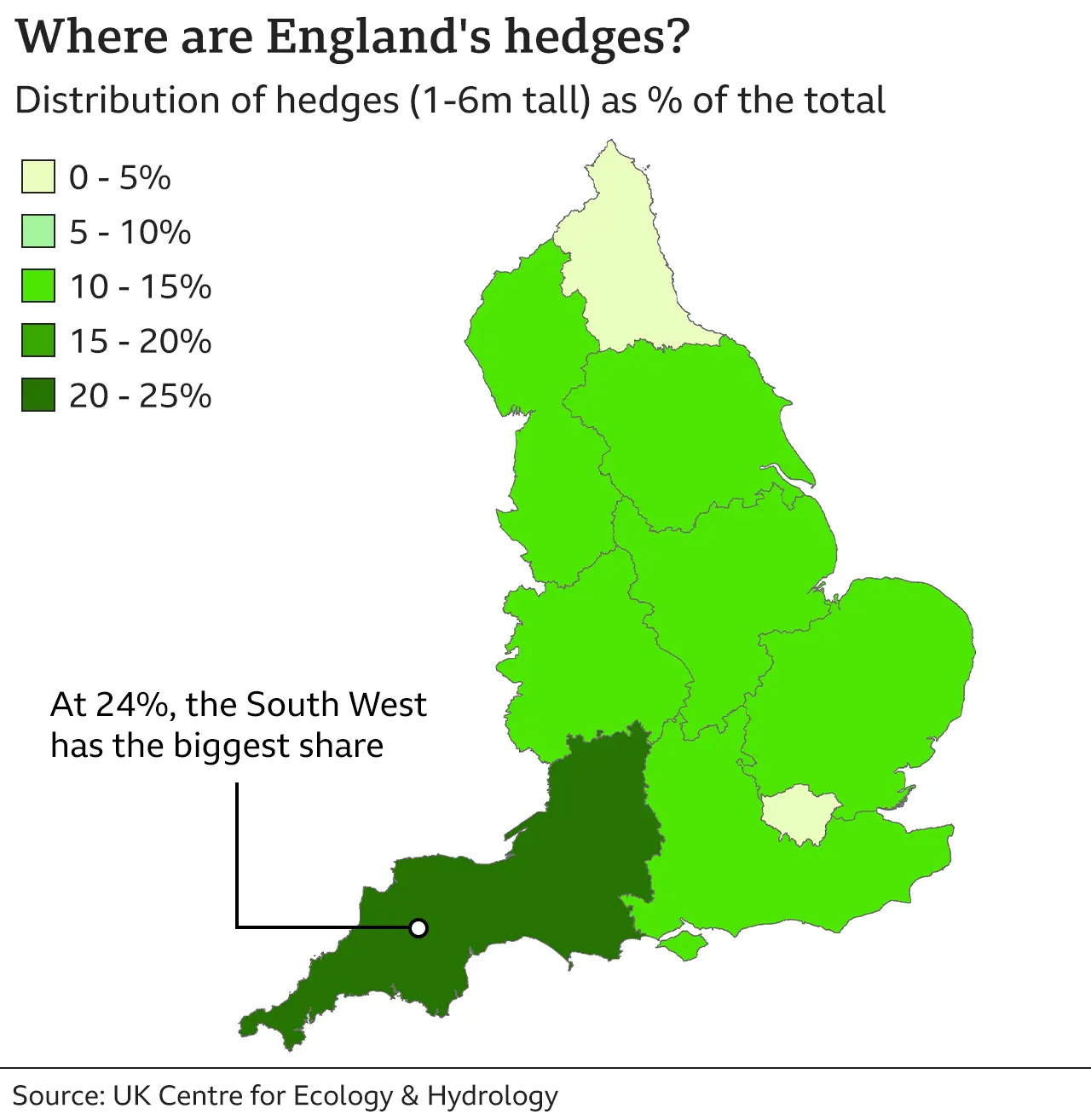
Aerial laser scanning has uncovered a staggering total of 390,000 km of hedges, with the South West proudly leading the pack, spearheaded by Cornwall. On the flip side, Surrey, Hampshire, and Berkshire boast the least, excluding major urban areas.
Dr. Richard Broughton, at the helm of the project with the UK Centre for Ecology and Hydrology, emphasizes the invaluable resource England possesses, stating, “We’ve probably got more hedgerows in England than anywhere else in the world, so we’re very lucky to have this huge resource.” The national initiative to expand hedgerows leverages this map to pinpoint gaps in the network that could be filled.
Hedgerows, an integral part of Britain’s rural history since the Bronze Age, delineate boundaries and shelter livestock. Teeming with hundreds of wild plant species, these green corridors provide nesting sanctuaries for birds, homes for small mammals and insects, and serve as crucial carbon sinks.
While half of Britain’s hedgerows were lost between the 1940s and 1990s, primarily in England due to intensive farming and development, efforts to curb this loss have been underway since the 1990s. However, challenges such as neglect, damage, and removal persist as significant threats.
The new map, crafted through aerial laser scanning using Lidar (Light Detection and Ranging) remote sensing data, marks a pivotal advancement. Unlike previous estimates scaled up from field surveys, this approach provides detailed insights on a national scale without the need to traverse every hedgerow.
According to the new data, England boasts 390,000 km of hedgerows measuring between 1 and 6 meters in height, along with an additional 67,000 km of lower hedges and 185,000 km of overgrown hedges exceeding 6 meters in height.
Key findings from the map include the South West leading with 24% of England’s hedges, while the northeast, excluding London, has the lowest share at 4%. At a county level, Somerset, Derbyshire, and Cornwall feature the highest densities, while Surrey, Hampshire, and Berkshire show the lowest densities, excluding urban areas.
The government’s commitment to create or restore 48,000 km of hedgerows by 2037 and 72,000 km by 2050, as outlined in the Environmental Improvement Plan released a year ago, promises a brighter future for these vital ecological features.


